Middle Mountain (FR 724)
The lake's backyard mountain: twelve miles of road, ATV loops, a karst-wilderness hike and a 1920s ghost camp.
- Trailer up — you can't ride there on the road. No La Plata County road (including CR 501) is open to OHVs; it's state law (C.R.S. 33-14.5-108), crossings only. See how to ride legal at Vallecito.
- Register: a Colorado CPW OHV registration is $26.25/yr (Apr 1–Mar 31) — residents, out-of-staters, and plated rigs alike on designated trails (no out-of-state reciprocity).
- Download the MVUM before you drive up. The Columbine District Motor Vehicle Use Map is the legal map of what's open to your vehicle class — and there's no cell service up there. Get the georeferenced PDF: fs.usda.gov/media/73572. Riding off designated routes is a federal violation.
- Spark arrester required; Colorado limits OHV sound (96 dB on new machines). Kids 10–15 on designated trails only under direct visual supervision; DOT helmet guidance for under-18.
- Season ~June 1 – Nov 30 (winter gate). Open-range cattle and cattle guards; storms build fast above 10,000 ft. Everything past the designated routes is Weminuche Wilderness — no motors or bikes, period.
- Current conditions/gate: Columbine Ranger District (970) 884-2512 (walk-in Fridays). The Oct-2025 flood damaged roads forest-wide — check SJNF conditions.
Roads & trails up Middle Mountain
Vehicle class is everything up here. Legend: full-size · OHV ≤50″ · motorcycle · foot & horse only.
| Route | Who | What it is |
|---|---|---|
| FR 724 — Middle Mountain Rd | full-size + everything registered | The spine to Tuckerville: about 12.2 miles from CR 501 (NE corner of the lake) — the first 0.5 mi is County Road 501.G, then 11.7 mi of FR 724, with mileposts 1–10 posted. Gravel and improved to the cattleguard just past the Cave Basin trailhead (small parking area + a seasonal gate); beyond it the road turns to native surface where higher clearance is encouraged, depending on conditions. Dusty, sharp corners. Route detail courtesy the San Juan NF (Forest GIS). |
| Beri ATV Trail #812 | ≤50″ · | 3.4 mi; begins and ends on FR 724 (a natural loop with the road). Southern half is rocky and steep with embedded slabs and 1,000+ ft of climb; the “Beri View” spur is the payoff. FS: “lovely views… especially in fall when the aspens change.” |
| Vallecito View #808 | ≤50″ · · | 1.7 mi dead-end spur to a ridge viewpoint (TH ~mile 9.5; 10,67011,380 ft). Hikers and horses allowed too — expect machines. FS-published season 6/1–11/30. |
| Runlett Park Trail | ≤50″ | A two-track off FR 724 ending at Dark Canyon #814 (no FS number/length published). |
| Dark Canyon #814 | single-track (no ATVs) | ~2.1–2.4 mi single-track dropping ~1,100 ft from Runlett back to FR 724; black-diamond and loose; horses and hikers share it. Single-track — confirm your vehicle class on the MVUM. |
| Cave Basin #530 | only (Wilderness) | Foot and horse only — it enters the Weminuche. TH ~mile 8–10, 4.5 mi one-way (10,80012,360 ft); karst sinkhole benches; “the majority of the hike is bushwhacking — use your map and compass” (FS). Overlook above Dollar Lake, with Emerald Lake 2,300 ft below. |
These routes on the map — color-coded by who's allowed. Other lake layers (campgrounds, marina, etc.) are off; toggle any on with the chips.
Toggle layers with the chips above; tap a route or pin for details. Map data OpenStreetMap contributors. See the full lake map .
Sources: San Juan National Forest trail pages + the Columbine RD MVUM; map geometry from the USFS EDW service.
The destinations
Tuckerville: the ghost camp
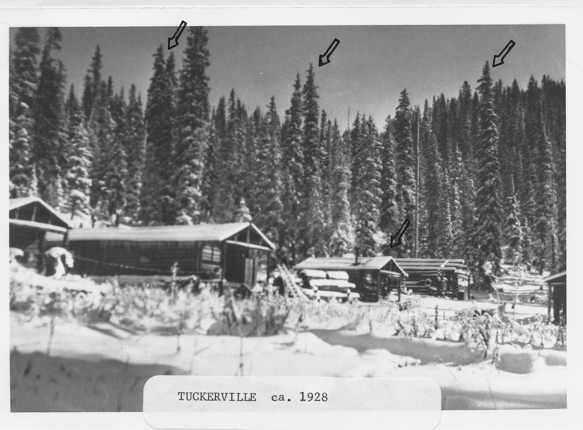
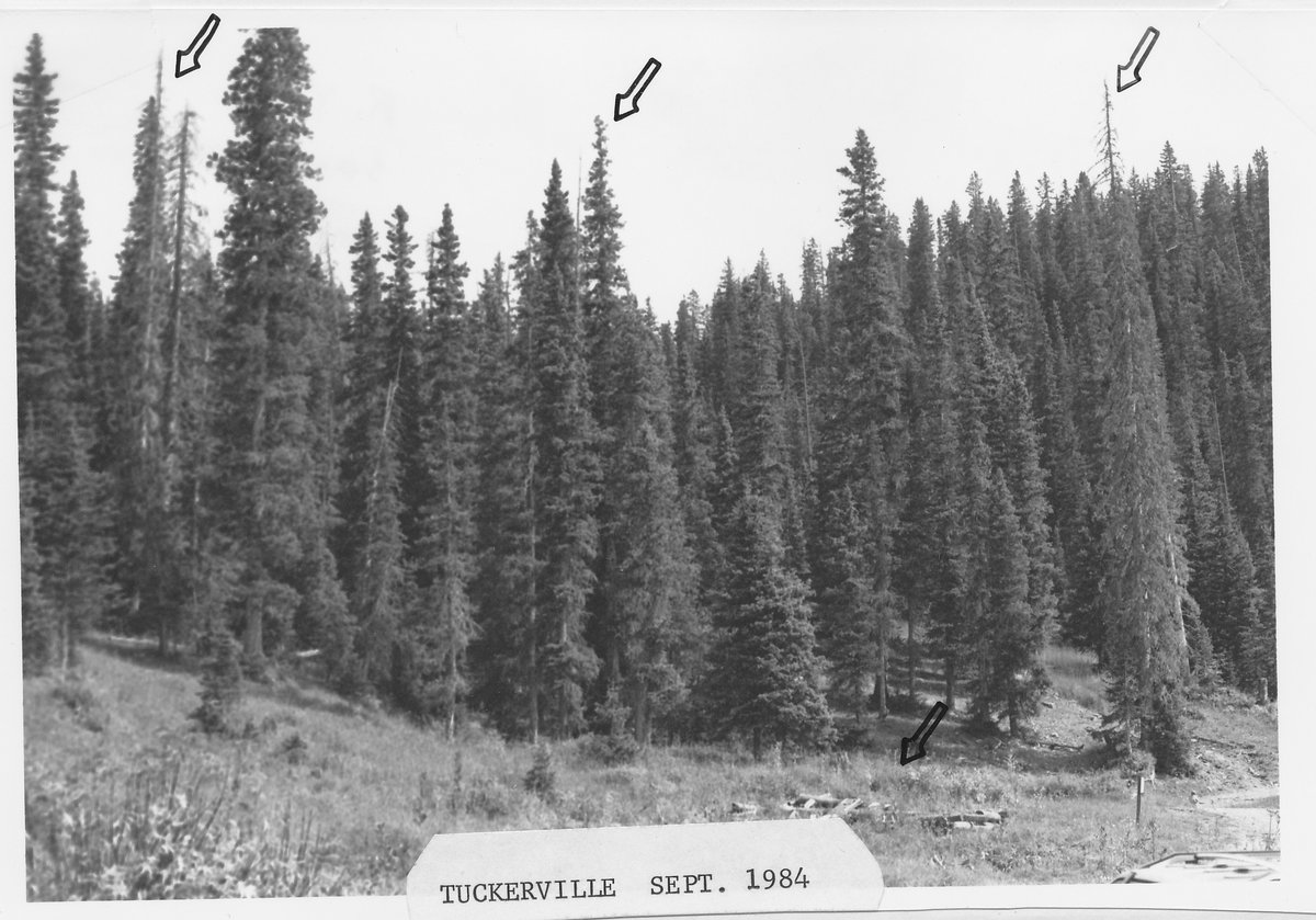
A 1913 strike in the Cave Basin Mining District grew into a 1920s camp of about seven log buildings, abandoned by 1928–29. Every building is gone; foundations, an overlook above the cliff mines and the story remain. Look, don’t take: the artifacts are federally protected (ARPA). Full history: Tuckerville (the camp) and Weaselskin (the man).
Then and now, 56 years apart: the hand-drawn arrows mark the same trees.
Runlett Park & the overlooks
A vast high meadow under the Runlett Peak / Granite Peak sightlines; the road's upper bends give the big look back down on the reservoir. The Cave Basin / Dollar Lake overlook is arguably the best non-technical viewpoint in the district.
Fall color
Beri's aspens are the Forest Service's own selling line — late September is the show. Fall is also hunting season up here, so expect more traffic and wear blaze orange off the machine.
Maps for Middle Mountain
There's no cell signal past the cattle guard — download or print before you leave the pavement. Only one of these is legally binding for where you can drive: the MVUM. The rest are for getting your bearings and chasing the history.
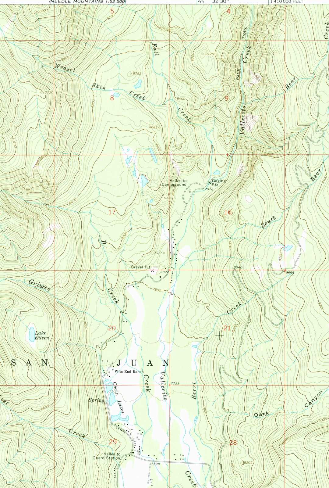
This country sits on the USGS Vallecito Reservoir quadrangle. The historic editions — public domain, free to view and download on USGS topoView — label Middle Mountain, Cave Basin, and, fittingly, Weasel Skin Creek, the drainage behind the old Tuckerville gold legend. For where your machine may legally travel, the modern Columbine Ranger District MVUM always governs.
Horses & hikers
Cave Basin #530 (foot/horse only) and Vallecito View #808 both allow stock — Cave Basin is the quiet Wilderness option, Vallecito View shares the tread with machines in season. On the motorized routes, everyone shares the trail: uphill traffic and stock have the right of way, and a friendly wave goes a long way. At the Wilderness boundary the rules change hard — no motors, no bikes, no mechanized anything. See our trail guide and wildlife guide (you'll likely meet cattle, and maybe a moose).
Basecamp & services
Middle Mountain Campground sits at the bottom, on the Pine River inlet (24 lakefront sites) — the natural basecamp. It's reservable on recreation.gov, about $28–32/night, open late May–September, max RV 35 ft, with potable water and no horse facilities.
There's no formal trailhead lot at the bottom of FR 724 — but Altitude ATV & Side-by-Side Rentals is based at the bottom of Middle Mountain Road (32 Middle Mountain Rd, (970) 403-2260) and offers park-and-ride rentals and trailering. Up top there are no services, no water, and no cell — fuel up, fill up, and download your map before you leave the pavement.
Top off the gas, air down a touch for the rocks, and tell someone your plan and your turnaround time. There's no bar of signal to call for a tow once you're past the cattle guard.
Page updated · Spot something wrong? Tell us