Tuckerville: the gold camp that never paid
A meadow at 10,600 feet where a town used to be, and a promoter still selling shares a year before everyone left.
A town that isn't there
Drive Middle Mountain Road (Forest Road 724) up from Vallecito Reservoir, park where the road gives out around 10,000 feet, and walk. About four and a half miles on, the trees open onto a grassy bench near Runlett Peak, at about 10,600 feet. This is Tuckerville. The buildings are gone; what's left is the meadow, an overlook above old cliff workings, and quiet. It sits in the Cave Basin mining district — and, contrary to a lot of the old write-ups, in Hinsdale County, not La Plata, where early accounts placed it by mistake.
The legend that lit the fuse
Every gold camp needs an origin story. Tuckerville’s is the tale of a Southern Ute man, Weaselskin, said to have paid for meals with raw gold nuggets from a strike he never named. It is a settler legend, traceable to a single retelling, with no Ute-side version. But it is woven into how the valley remembers this place. We tell it in full, alongside the man’s documented life, on its own page.
Weaselskin — the man the valley named twice
The Valley Under the Lake — the ranching valley the reservoir covered
1913: a strike on the Dowell property
La Plata County's official history is blunt about how thin the mining really was up here. “No significant 'strikes' occurred until 1913,” it records, "when gold was found in the Cave Basin area on the Dowell property. The nearby Acord and Tom Boy claims also yielded some gold.“ A year later, ”the May Murphy Mine claim in 1914 added to the local gold fever and a small town, Tuckerville, developed to serve the miners in the remote Cave Basin."
That is the documented arc: a real 1913 discovery, a flurry of claims, and a camp thrown up to serve them — the fever outrunning the ore almost from the start. (The claim appears as “May Murphy” in the county history and “Mary Murphy” in the state geological record; it's the same mine, spelled two ways.)
Source: Seyfarth & Lambert, Pioneers, Prospectors and Trout: A Historic Context for La Plata County, Colorado (2010), p. 27.
What they actually built
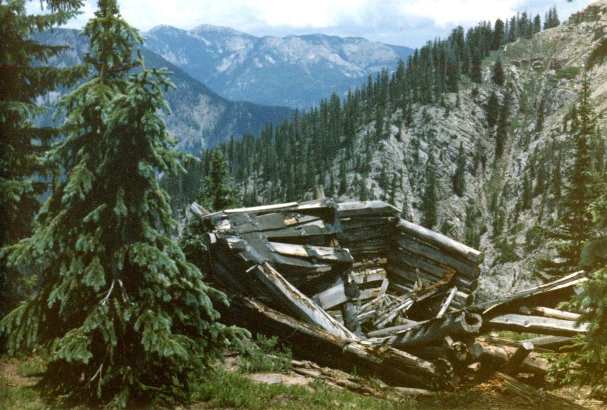
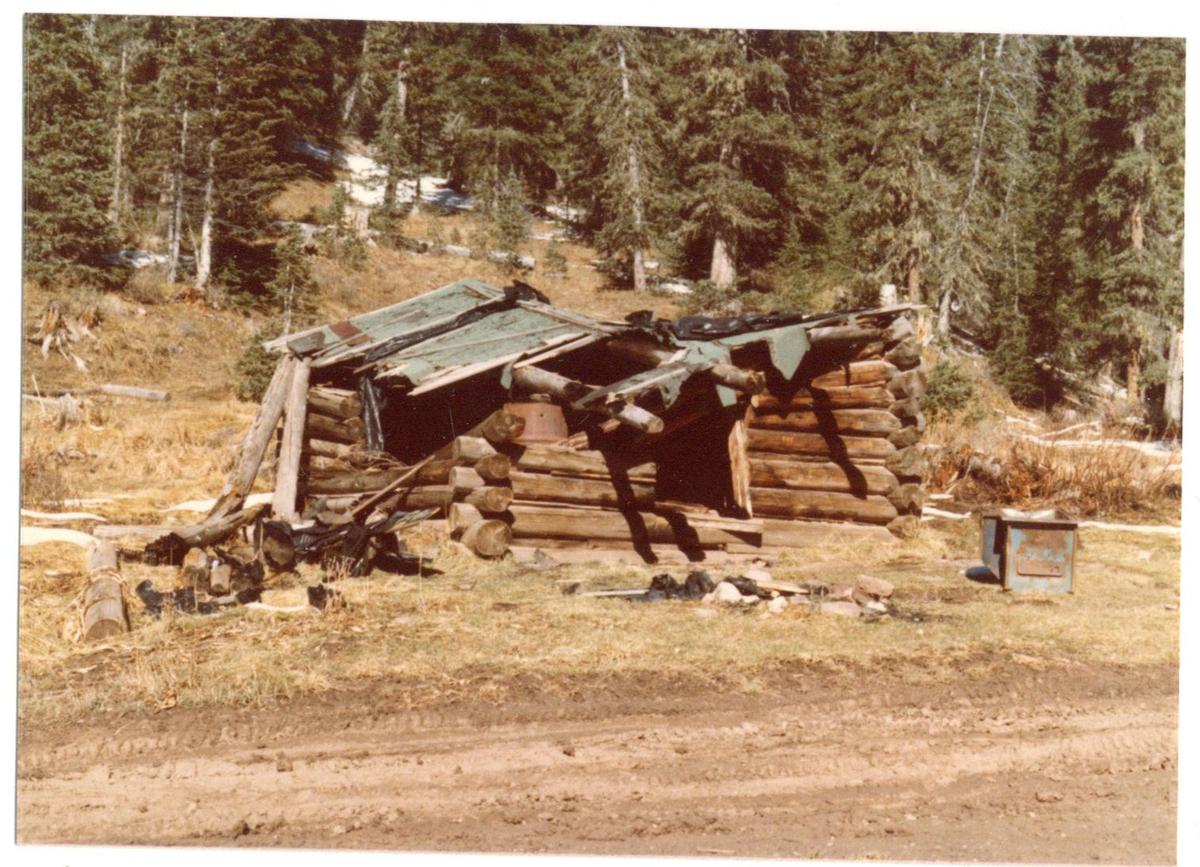
The county history is spare and specific: in the Pine River drainage, "Tuckerville, a gathering of seven log buildings served the miners in the little boom of the late 1910s. It was abandoned in 1928. No standing buildings remain." This was a hard place to keep a town — a ridge near 10,600 feet where winter is measured in survival, not months.
Other accounts count it a little differently, and none is firsthand: a local trails history says six bunkhouses, a shop, and a mess hall “in full operation from 1920 to 1929”; a regional almanac says the place “never amounted to more than several log cabins and a dining hall.” Seven buildings or six-plus-a-mess-hall, 1928 or 1929 — the histories don't quite agree, and we lead with the county's count rather than pretend they do.
Still selling the dream: one year before the end
On February 10, 1928, the Durango Evening Herald ran an advertisement from the Mount Runlett Metals Company of Cortez, promoting “the new mining camp of Tuckerville.” By then the first excitement was fifteen years old — and the camp was the same year it was abandoned. We don't call that a swindle, because no source documents fraud. We just note that the promotion was still running as the ore ran out.
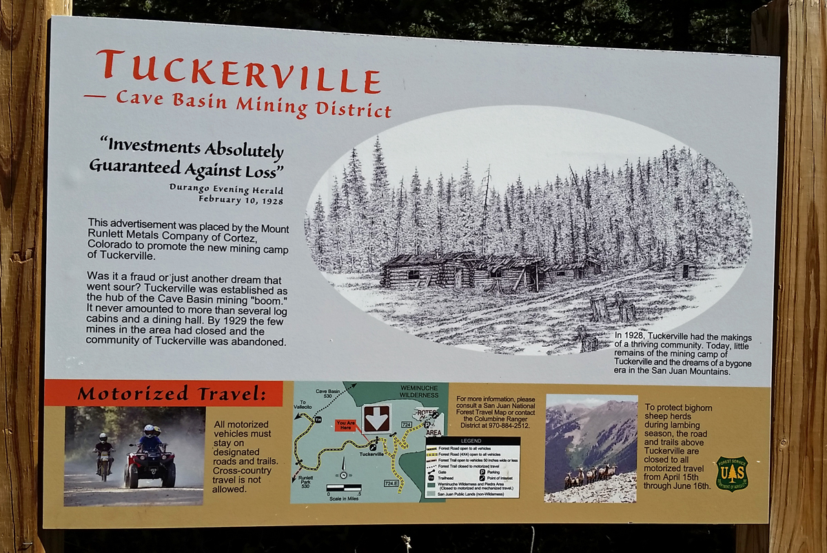
Two facts sharpen the picture. The company sold shares in the “Mount Runlett” deposits, yet in 1947 the state’s compiling geologist, J. W. Vanderwilt, noted ore reported “on the slopes of Mount Runlett, which he could not locate.” And the Mount Runlett Metals Company appears in no corporate registry we could find, just as no source anywhere names who “Tucker” was. Both are gaps, not proof of anything.
The ledger doesn't lie
So — was there gold? A little. The recorded production credited to the district is small enough to list in full. The Colorado Geological Survey, quoting Steven and others (1969), tallies the Holbrook, Mary Murphy, and Silver Reef veins over the whole sporadic run of 1913–1928 at just this:
| Gold | 12 oz |
|---|---|
| Silver | 237 oz |
| Copper | 2,900 lb |
| Lead | 1,700 lb |
A short revival in the mid-1930s added the rest: USGS Bulletin 1434 records 62 tons of ore for 109 ounces of gold in 1934–36 — figures first misattributed to “Vallecito Basin” and later corrected to Cave Basin. Add the two together and the district's entire documented lifetime gold output is about 121 ounces.
“…small quantities of high-grade ore, which was packed out on horses and mules.”
USGS Bulletin 1261-F (1969)
About 120 ounces of gold across a quarter-century — it would fit in a coffee can. That is the whole yield of the dream, packed out on animals an ounce or two at a time.
Production figures: Colorado Geological Survey, Metal Mining Districts of Colorado (2015), quoting Steven et al. (1969); and USGS Bulletin 1434 (1977). Quote: USGS Bulletin 1261-F (1969).
1928: a ghost
The camp was abandoned in 1928, the county history says, with mining “waned to almost no activity” by 1929. There were sporadic pokes at the ground into the mid-1930s — the small 1934 and 1935–36 lots are the record of them — and then silence. Nobody moved back.
“…these figures should have been credited to Cave Basin, an area of small production…”
USGS Bulletin 1434 (1977)
The government's autopsy, and the land's next life
In 1969 the U.S. Geological Survey published a mineral survey of the San Juan Primitive Area, Bulletin 1261-F, and looked hard at Cave Basin. Its verdict was final:
None of these deposits appears to be large enough to have economic potential.USGS Bulletin 1261-F (1969)
That 1261-F survey was itself a Wilderness Act study (Public Law 88-577): the government was appraising Cave Basin's minerals precisely to decide whether the country around it should become protected wilderness. Finding no paying ore helped clear the way. The miners' bust became the wilderness's case — this ground went to the Weminuche, not the mines.
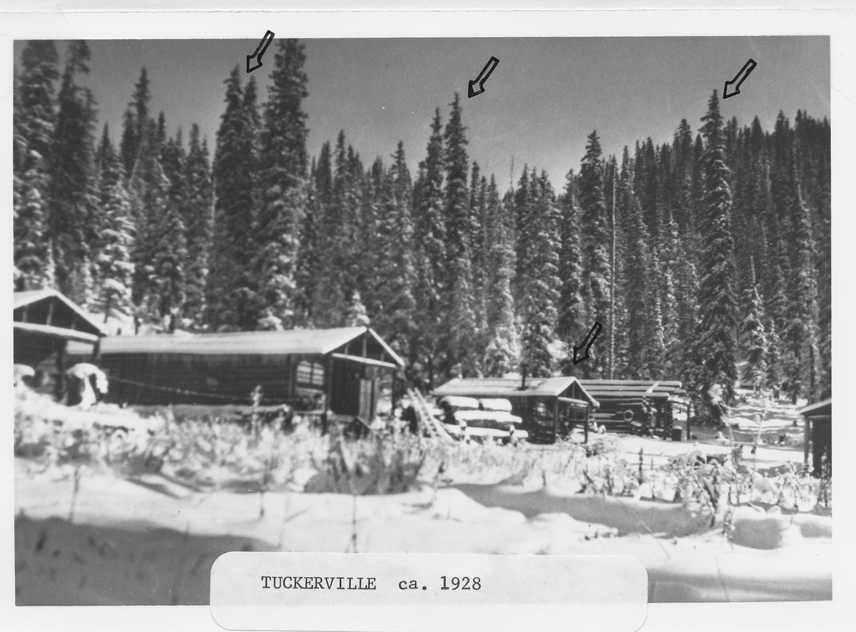
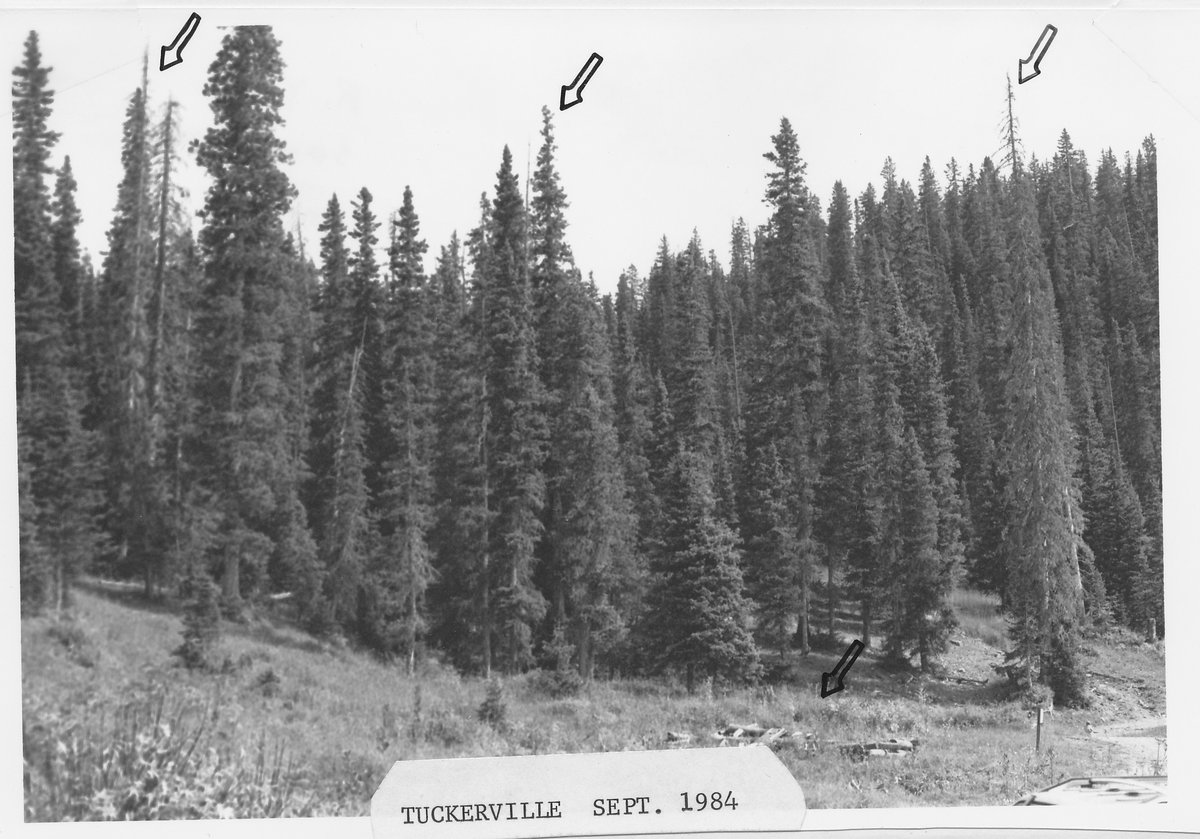
Two Forest Service photographs make the reclamation literal — the same spot, 56 years apart, the hand-drawn arrows marking the same trees:
The real find took another 67 years, and it wasn't gold
Tuckers Tunnel, the prospect about a mile south of the townsite near Runlett Peak, turned out to hold something no assayer in 1913 was looking for. In 1980, during a uranium survey, Nicholas Theis and Michael Madsen collected a mineral there that had never been described anywhere on Earth. Named theisite and formally published in 1982, Tuckers Tunnel is its world type locality — the one place science first knew it from. The camp that never found paying gold gave the world a mineral instead.
Theisite: mindat (type locality loc-6211); Williams, Mineralogical Magazine 46:49–50 (1982).
Go stand there
The Forest Service still points the way. Its current guidance notes that Middle Mountain Road (FR 724) “leads to the upper Bear Creek drainages and Runlett Park, as well as the old mining town of Tuckerville.” Here is how to reach it.
- The drive: FR 724 from Vallecito Reservoir is drivable roughly 8 miles to a parking area around 10,000 feet (high-clearance; the gate is sometimes locked).
- The walk: from parking it's about a 4.5-mile trail to the Tuckerville meadow, with a Cave Basin loop option; La Plata County's historic driving tour marks the route with interpretive signage.
- Season: roughly June 1 – November 30, snow depending — see Middle Mountain.
- Leave it as you found it: the site is protected under the Archaeological Resources Protection Act. Look, photograph, and leave everything where it lies — artifacts, timbers, tailings. Take nothing.
What you'll find up there is subtle. Cave Basin is a karst basin — its sinkholes and caves give it the name — and the mining left small marks: “small diggings and piles of rock,” one recent hiker's account notes, “some with small amounts of copper mineralization colored green, blue, or turquoise, dug by prospectors looking for gold long ago.” Southeast of the main karst, “several mines and old log cabins … can be explored if you know where to look. All are relics from the 'Tuckerville' mining era.”
Pair it with the route notes and OHV rules on Middle Mountain and the wider Vallecito trail guide.
Site-today notes: Bob Thompson, “Cave Basin Hike,” Seniors Outdoors! newsletter, March 2021.
Hiked the trail yourself? If you have photos of the meadow or the overlook, we'd be glad to feature them — send them in
Sources & notes
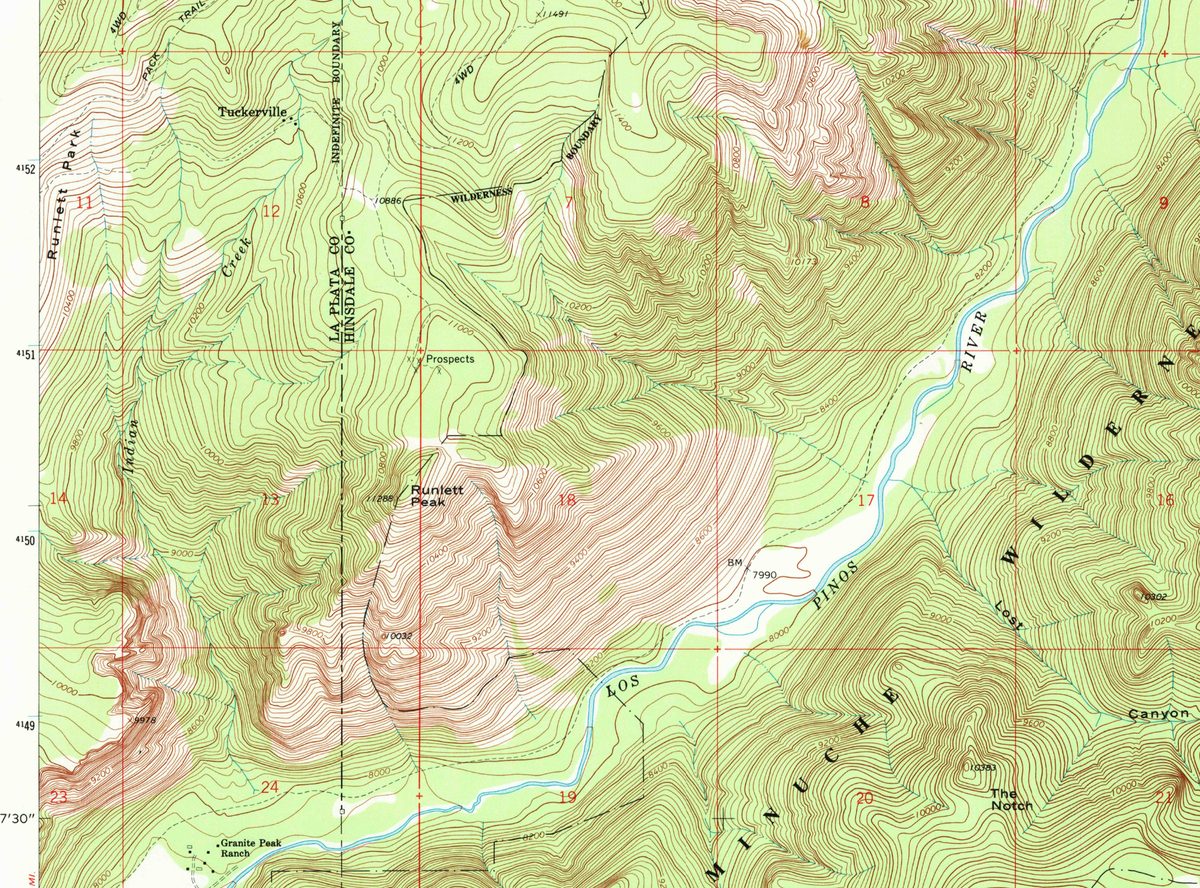
No known photograph of the Tuckerville camp survives online. We looked; if one exists in a family album or a historical-society collection, we'd be glad to feature it — get in touch. The one period image we could place is the 1928 advertisement above, which itself survives only as a reproduction in the Okie Legacy eZine — a manual search of the Colorado Historic Newspapers Collection found no original. The 1964 USGS Granite Peak quadrangle crop shown above is a public-domain USGS map.
Primary sources
- Seyfarth & Lambert, Pioneers, Prospectors and Trout: A Historic Context for La Plata County, Colorado (2010), the county’s official history, used as the backbone.
- Colorado Geological Survey, Metal Mining Districts of Colorado (2015), quoting Steven and others (1969).
- USGS Bulletin 1261-F (1969) and Bulletin 1434 (1977).
- J. W. Vanderwilt, Mineral Resources of Colorado (1947).
- U.S. Forest Service, San Juan National Forest: Middle Mountain Campground page, updated May 22, 2026; Columbine Ranger District, Bayfield, (970) 884-2512.
- La Plata County Historic Preservation’s self-guided driving tours.
- Bob Thompson, “Cave Basin Hike” (Seniors Outdoors!, March 2021).
- Mineralogy: mindat.org and the Colorado School of Mines Geology Museum (Haynes & Hlava, Rocks & Minerals 73(5), 1998).
- The 1928 advertisement: Okie Legacy eZine.
- The Weaselskin story: Vallecito lore (Warlick, Vallecito Country, p. 22), told in full on the Weaselskin page.
This is a living community record. If you can source what we couldn't — a photograph, the identity of “Tucker,” a documented population — we'd like to hear it